Category:South Gloucestershire District
Jump to navigation
Jump to search
unitary authority of England  | |||||
| Upload media | |||||
| Instance of | |||||
|---|---|---|---|---|---|
| Location | Gloucestershire, South West England, England | ||||
| Capital | |||||
| Legislative body |
| ||||
| Population |
| ||||
| Area |
| ||||
| Replaces | |||||
| official website | |||||
 | |||||
Subcategories
This category has the following 20 subcategories, out of 20 total.
Media in category "South Gloucestershire District"
The following 200 files are in this category, out of 256 total.
(previous page) (next page)-
 A footpath in Yate, Bristol - geograph.org.uk - 364848.jpg 640 × 480; 91 KB
-
 Activity at Westerleigh. - panoramio.jpg 2,592 × 1,620; 1.07 MB
-
 Airbus A380 over Abbey Wood - geograph.org.uk - 171715.jpg 640 × 480; 49 KB
-
 Another footpath in Yate, Bristol - geograph.org.uk - 364872.jpg 640 × 480; 104 KB
-
 Autumn beeches on Oakford Lane - geograph.org.uk - 1036476.jpg 640 × 447; 128 KB
-
 Aztec Centre.jpg 640 × 480; 70 KB
-
 Aztec West Transport.svg 500 × 500; 20 KB
-
 B4465 Westerleigh Road with tractor - geograph.org.uk - 1505521.jpg 640 × 533; 157 KB
-
 Ba-Kar-Ee Box.jpg 3,024 × 4,032; 3.16 MB
-
 Ba-Kar-Ee Rules.jpg 3,024 × 4,032; 2.33 MB
-
 Ba-Kar-Ee Scores.jpg 3,024 × 4,032; 2.34 MB
-
 Badminton horse trials - geograph.org.uk - 326846.jpg 640 × 480; 75 KB
-
 Barn and trailer - geograph.org.uk - 314687.jpg 640 × 480; 109 KB
-
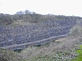 Barnhill quarry, Chipping Sodbury - geograph.org.uk - 322740.jpg 640 × 480; 92 KB
-
 Beech copse on Lansdown - geograph.org.uk - 717903.jpg 640 × 488; 137 KB
-
 Beeks Mill Lane. - panoramio.jpg 2,448 × 3,264; 4.71 MB
-
 Bicycle Stand, Bitton Railway Station. - panoramio.jpg 2,736 × 3,648; 3.38 MB
-
 Bitterwell Lake Car Park.JPG 1,280 × 960; 595 KB
-
 Bitterwell Lake.JPG 1,280 × 960; 598 KB
-
 Bradley Stoke lake.jpg 2,048 × 1,536; 854 KB
-
 Bradley.stoke.leisure.centre.arp.750pix.jpg 750 × 521; 119 KB
-
 Bridge over River Boyd, Golden Valley. - panoramio.jpg 3,456 × 2,508; 3.09 MB
-
 Bridleway by Kington Down Cottage - geograph.org.uk - 327031.jpg 640 × 480; 35 KB
-
 CableFree Pearl CPE Installed in The Cotswolds - V-Closeup.jpg 927 × 1,431; 287 KB
-
 Charlton Common, Brentry - geograph.org.uk - 115781.jpg 640 × 480; 160 KB
-
 Chris Wood golfprofessional.JPG 2,112 × 2,816; 2.59 MB
-
 Coldharbour Farm in the distance - geograph.org.uk - 254924.jpg 640 × 480; 67 KB
-
 Communications Mast, Horton. - panoramio.jpg 1,987 × 2,497; 789 KB
-
 Coombes Wood from Beeks Lane. - panoramio.jpg 3,648 × 2,736; 4.33 MB
-
 Crossways Infants School, Thornbury - geograph.org.uk - 314835.jpg 640 × 480; 68 KB
-
 Cycle route at Broad Lane.jpg 828 × 548; 152 KB
-
 Disused railway - geograph.org.uk - 190828.jpg 480 × 640; 116 KB
-
 Disused Railway Line at Bitterwell.JPG 1,280 × 960; 598 KB
-
 Early Spring, River Boyd, Golden Valley. - panoramio.jpg 3,438 × 2,394; 3.59 MB
-
 Electricity pylon - geograph.org.uk - 190181.jpg 480 × 640; 90 KB
-
 English Country Side - panoramio.jpg 3,407 × 1,990; 5.06 MB
-
 Entrance Lodge, Dodington Estate. - panoramio.jpg 2,816 × 2,112; 2.97 MB
-
 Farm buildings - geograph.org.uk - 831000.jpg 640 × 480; 88 KB
-

-
 Field of oats near Kington Down Farm - geograph.org.uk - 1449971.jpg 640 × 463; 158 KB
-
 Fifteen Acre Farm - geograph.org.uk - 251056.jpg 640 × 480; 110 KB
-
 First 'wild' daffodils of 2007 - geograph.org.uk - 314695.jpg 640 × 480; 138 KB
-
 Fishing at Bitterwell Lake.JPG 1,280 × 960; 566 KB
-
 Former Fox Inn, Old Sodbury. - panoramio.jpg 2,793 × 1,781; 1,001 KB
-
 Freezing Hill - geograph.org.uk - 713524.jpg 640 × 460; 101 KB
-
 Full Moon Rising over Kelston - panoramio.jpg 1,200 × 800; 650 KB
-
 Gas Pressure Station, Siston. - panoramio.jpg 2,575 × 2,010; 1.46 MB
-
 Henfield Youth AFC former ground.jpg 1,172 × 715; 169 KB
-
 Henfield Youth AFC training floodlights.jpg 646 × 477; 41 KB
-
 Horton Court. - panoramio (1).jpg 2,112 × 2,816; 2 MB
-
 Horton Court. - panoramio.jpg 2,816 × 2,112; 3.54 MB
-
 Ingleside Road at the junction of Syston Way - geograph.org.uk - 6174361.jpg 1,920 × 1,280; 1.21 MB
-
 Inquisitive livestock - geograph.org.uk - 251060.jpg 640 × 480; 128 KB
-
 Iron fairy. - geograph.org.uk - 552772.jpg 640 × 512; 177 KB
-
 John Lewis central atrium at Christmas.jpg 2,433 × 3,406; 2.93 MB
-
 K6 Telephone Kiosk Outside Library.jpg 1,289 × 2,131; 817 KB
-
 Kelston Round Hill from Clay Lane. - panoramio.jpg 2,394 × 1,795; 842 KB
-
 Keynsham Lock - panoramio.jpg 2,572 × 3,600; 8.16 MB
-
 Kingswood , Soundwell Road - geograph.org.uk - 3321844.jpg 4,288 × 2,848; 4.81 MB
-
 Kingswood , Soundwell Road A4017 - geograph.org.uk - 3321843.jpg 4,288 × 2,848; 5.37 MB
-
 Kingswood Hill. - panoramio.jpg 2,816 × 2,112; 2.26 MB
-
 Landscape at Ram Hill.JPG 1,280 × 960; 565 KB
-
 Lower scarp slopes near Horton - geograph.org.uk - 1659803.jpg 640 × 433; 84 KB
-
 Mall Cribbs Causeway Christmas Tree.jpg 1,701 × 3,177; 2.3 MB
-
 MargaretBrent.gif 300 × 333; 115 KB
-
 Martin Croft Brake Broadleaved Woodland.JPG 1,280 × 960; 587 KB
-
 Martin Croft Brake.JPG 1,280 × 960; 594 KB
-
 Meadow along Cotswold scarp, Horton - geograph.org.uk - 1658739.jpg 516 × 640; 124 KB
-
 Midger.jpg 640 × 426; 160 KB
-
 Newman Field.JPG 1,280 × 960; 592 KB
-
 Old Boundary Marker (geograph 6435886).jpg 466 × 960; 58 KB
-
 Old Sodbury Tunnel, Ventilation Shaft on skyline. - panoramio.jpg 2,081 × 2,309; 1.24 MB
-
 Old tractor at a farm at Hillesley - geograph.org.uk - 314894.jpg 640 × 426; 136 KB
-
 Oldbury Pill. - panoramio.jpg 3,648 × 2,736; 2.66 MB
-
 Oxleaze Farm near Hillesley - geograph.org.uk - 313818.jpg 640 × 426; 117 KB
-
 Passing place on Bury Hill Lane - geograph.org.uk - 1612510.jpg 640 × 474; 42 KB
-
 Path to Felicity Park - geograph.org.uk - 4502811.jpg 1,920 × 2,111; 573 KB
-
 Pipley Bottom - geograph.org.uk - 598518.jpg 640 × 427; 117 KB
-
 Playing fields - geograph.org.uk - 76778.jpg 640 × 480; 54 KB
-
 Playing Fields at Filton - geograph.org.uk - 121419.jpg 640 × 480; 95 KB
-

-

-

-

-
 Quarry - geograph.org.uk - 334339.jpg 640 × 432; 42 KB
-
 Rac.tower.arp.600pix.jpg 600 × 628; 112 KB
-
 Rails to South Wales - geograph.org.uk - 83757.jpg 640 × 480; 140 KB
-
 Ram Hill Pit. - panoramio (1).jpg 2,921 × 4,497; 7.76 MB
-
 Ram Hill Pit. - panoramio.jpg 5,312 × 2,988; 2.64 MB
-
 Road across Hawkesbury Common - geograph.org.uk - 313803.jpg 640 × 426; 94 KB
-

-
 Round Barrow in Barrow Field, Bitton. - panoramio.jpg 3,648 × 2,736; 2.49 MB
-
 Roundabout with coal tub - geograph.org.uk - 582253.jpg 640 × 512; 92 KB
-
 Severn Bridge and Cattle at Whale Wharf. - panoramio.jpg 3,648 × 2,736; 2.54 MB
-
 Severn from May Hill.jpg 2,048 × 1,536; 835 KB
-
 SGlos 2011 Composition.png 360 × 185; 21 KB
-
 SGlos 2015 Composition.png 355 × 185; 11 KB
-
 Site of Churchleaze No. 1 Pit.JPG 1,280 × 960; 589 KB
-

-
 Soundwell Playing Field. - panoramio.jpg 2,589 × 2,013; 1.12 MB
-
 South Gloucestershire Council 2023.svg 360 × 185; 4 KB
-
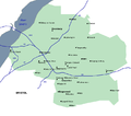 South Gloucestershire places.png 720 × 638; 15 KB
-
 South Gloucestershire UK ward map 2019.svg 712 × 687; 341 KB
-
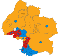 South Gloucestershire UK ward map 2023.svg 712 × 687; 341 KB
-
 St. Catherines Valley. - panoramio (1).jpg 3,264 × 2,448; 4.65 MB
-
 Staple Hill Police Station. - panoramio.jpg 2,707 × 1,961; 2.61 MB
-
 Stone Direction Sign. - panoramio - Bob&Anne Powell (1).jpg 2,253 × 1,729; 1.2 MB
-
 Stone Direction Sign. - panoramio - Bob&Anne Powell (2).jpg 2,653 × 1,741; 1.22 MB
-
 Stone Direction Sign. - panoramio - Bob&Anne Powell (3).jpg 2,489 × 1,913; 1.14 MB
-
 Street Art, Hollow Road. - panoramio.jpg 2,673 × 1,889; 1.31 MB
-
 Stunted Ash Tree with Coombes Wood beyond. - panoramio.jpg 3,264 × 2,448; 4.31 MB
-
 Summer Fun - panoramio.jpg 3,660 × 2,928; 8.45 MB
-
 Syston Way, Hopewell Hill - geograph.org.uk - 6174367.jpg 1,844 × 1,152; 1.3 MB
-
 Syston Way, Hopewell Hill - geograph.org.uk - 6174371.jpg 1,920 × 1,280; 1.01 MB
-
 Syston Way, Kingswood. - panoramio.jpg 2,592 × 1,897; 1.09 MB
-
 The Grange Hotel - geograph.org.uk - 357967.jpg 480 × 640; 121 KB
-
 The Horseshoe, Siston Common. - panoramio.jpg 2,592 × 1,952; 1.13 MB
-
 The Italian Bridge, Abbey Wood - geograph.org.uk - 171718.jpg 640 × 480; 55 KB
-
 The New Kingswood Health Centre. - panoramio.jpg 1,889 × 1,315; 580 KB
-
 The Old Flower Pot Inn, Hill Street, Kingswood. - panoramio.jpg 2,592 × 1,839; 1.02 MB
-
 The Old Rectory ^ St Annes Church, Siston. - panoramio.jpg 2,501 × 1,548; 897 KB
-
 The Severn Vale. - panoramio.jpg 3,574 × 2,353; 1.87 MB
-
 Thornbury toddler and dog (Unsplash).jpg 3,057 × 2,038; 746 KB
-
 Toll House, Dodington. - panoramio.jpg 2,601 × 1,849; 1.39 MB
-
 Track above Upper Chalkley Farm - geograph.org.uk - 1659533.jpg 640 × 449; 93 KB
-
 Trees on Horton Hill - geograph.org.uk - 1658177.jpg 640 × 463; 92 KB
-
 Turnpike Road Boundary Post. 1823. - panoramio.jpg 2,038 × 2,619; 895 KB
-
 Un-named stream - geograph.org.uk - 254932.jpg 640 × 480; 157 KB
-
 Under seven bridge England end - panoramio - cowbridgeguide.co.uk.jpg 2,048 × 1,536; 248 KB
-
 Under seven bridge England end - panoramio.jpg 2,048 × 1,536; 295 KB
-
 Unusual view of Frenchay Hospital. - panoramio.jpg 2,592 × 1,952; 1.08 MB
-
 Uptoncombe.jpg 640 × 426; 121 KB
-
 Waterlogged ground - geograph.org.uk - 322708.jpg 640 × 480; 119 KB
-
 Westerleigh Viaduct from Milepost 121 1-4 - panoramio.jpg 3,648 × 2,736; 3.09 MB
-
 Westerleigh Viaduct from MP 121 1-4 - panoramio.jpg 3,648 × 2,736; 3.2 MB
-
 Westerleigh Viaduct. - panoramio.jpg 3,648 × 2,736; 3.42 MB
-
 Weymouth Dock Pannier Tank at Bitton Station. - panoramio.jpg 3,648 × 2,736; 2.39 MB
-
 Widden Hill House (2) - geograph.org.uk - 1658395.jpg 640 × 456; 77 KB
-
 Wilton's Yard - geograph.org.uk - 254906.jpg 640 × 480; 124 KB
-
 Yate Lifestyle Centre - Near Armadillo Youth Cafe.jpg 1,440 × 1,920; 273 KB
-

-

-

-
 A38 Bristol - geograph.org.uk - 1130771.jpg 640 × 360; 45 KB
-
 A420 Marshfield next left - geograph.org.uk - 1800517.jpg 640 × 483; 81 KB
-
 A420 near Marshfield - geograph.org.uk - 1040930.jpg 640 × 464; 262 KB
-
 Approaching Badminton - geograph.org.uk - 314660.jpg 640 × 480; 66 KB
-
 Ashwicke Road heading for Marshfield - geograph.org.uk - 1037279.jpg 640 × 489; 121 KB
-
 Autumn is coming fast. - geograph.org.uk - 552774.jpg 640 × 512; 185 KB
-
 Ayford Lane going down - geograph.org.uk - 1800467.jpg 640 × 485; 123 KB
-
 Badminton High Street - geograph.org.uk - 326838.jpg 640 × 480; 60 KB
-
 Badminton High Street - geograph.org.uk - 326840.jpg 640 × 480; 59 KB
-
 Badminton House - geograph.org.uk - 326849.jpg 640 × 480; 49 KB
-

-
 Blisbury Farm - geograph.org.uk - 314696.jpg 640 × 480; 95 KB
-
 Bridge over a culvert - geograph.org.uk - 314683.jpg 640 × 480; 95 KB
-
 Bridleway to Shepperdine - geograph.org.uk - 314712.jpg 640 × 480; 130 KB
-
 Broadmead Brook - geograph.org.uk - 327059.jpg 640 × 480; 35 KB
-

-
 Church Hill, Oldbury on Severn. - geograph.org.uk - 681905.jpg 640 × 480; 107 KB
-
 Converted farm buildings - geograph.org.uk - 314802.jpg 640 × 480; 86 KB
-
 Corner of Priest Wood - geograph.org.uk - 489692.jpg 640 × 480; 159 KB
-
 Cotswold farmland - geograph.org.uk - 119911.jpg 640 × 480; 92 KB
-
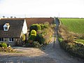
 Cottage at Orange End, near Hawkesbury - geograph.org.uk - 313809.jpg 640 × 426; 121 KB
-
 Cottage by a bend in the lane. - geograph.org.uk - 314685.jpg 640 × 480; 99 KB
-
 David Hathaway Transport depot - geograph.org.uk - 674527.jpg 640 × 384; 43 KB
-
 David Hathaway warehouse - geograph.org.uk - 367422.jpg 640 × 453; 81 KB
-
 Dayhouse Farm - geograph.org.uk - 314690.jpg 640 × 480; 65 KB
-
 Dorian Road Pre-fabs - geograph.org.uk - 255289.jpg 480 × 640; 65 KB
-

-
 Entrance to Court Farm - geograph.org.uk - 255689.jpg 640 × 480; 58 KB
-
 Farmland from the rail viaduct - geograph.org.uk - 674574.jpg 640 × 512; 64 KB
-

-
 Fatting barn - geograph.org.uk - 326843.jpg 640 × 480; 64 KB
-
 Field entrance on Old Down Road - geograph.org.uk - 314659.jpg 640 × 480; 64 KB
-
 Field of rape - geograph.org.uk - 382408.jpg 640 × 480; 108 KB
-
 Field opposite Gloucester Road Farm - geograph.org.uk - 357975.jpg 640 × 480; 91 KB
-
 Flood Bank - geograph.org.uk - 149688.jpg 640 × 480; 97 KB
-
 Flood defences on the Severn - geograph.org.uk - 189807.jpg 640 × 480; 81 KB
-
 Flower or weed^ - geograph.org.uk - 552769.jpg 640 × 512; 148 KB
-
 Fly tipping on Rock Road - geograph.org.uk - 355852.jpg 640 × 480; 100 KB
-
 Focus - geograph.org.uk - 717650.jpg 640 × 399; 45 KB
-
 Footpath to Buckover - geograph.org.uk - 314821.jpg 640 × 480; 104 KB
-
 Footpath to Duckhole - geograph.org.uk - 314796.jpg 640 × 480; 93 KB
-
 Footpath to Severn Beach - geograph.org.uk - 731443.jpg 640 × 480; 118 KB
-
 Fragrant fields near Hawkesbury - geograph.org.uk - 173212.jpg 640 × 481; 134 KB
-
 Freezing Hill - geograph.org.uk - 254895.jpg 640 × 480; 79 KB
-
 Frogland Cross - geograph.org.uk - 33322.jpg 640 × 480; 52 KB
-
 Garages in the snow - geograph.org.uk - 334641.jpg 640 × 480; 99 KB
-
 Garages, Horfield Common - geograph.org.uk - 1400952.jpg 640 × 438; 94 KB
-
 Gas container - geograph.org.uk - 190177.jpg 640 × 480; 96 KB
-
 Gas works - geograph.org.uk - 190176.jpg 640 × 480; 90 KB
-
 Gas works - geograph.org.uk - 190179.jpg 640 × 480; 68 KB
-
 Golf Course Lane, Filton - geograph.org.uk - 112515.jpg 640 × 480; 121 KB
-
 Grovesend House - geograph.org.uk - 314839.jpg 640 × 480; 73 KB
-
 Guinea fowl at Badminton farm - geograph.org.uk - 316918.jpg 640 × 480; 113 KB
-
 Hallen Road - geograph.org.uk - 118446.jpg 640 × 480; 176 KB
-
 Hallen Road, Henbury - geograph.org.uk - 115805.jpg 480 × 640; 191 KB
-
 Hebden farm - geograph.org.uk - 326912.jpg 640 × 480; 62 KB
-
 Housing off Concorde Drive - geograph.org.uk - 387701.jpg 640 × 480; 160 KB


.jpg)


.jpg)


.jpg)
.jpg)
.jpg)
.jpg)


.jpg)


_...Due_for_closure._-_panoramio.jpg)


.jpg)

.jpg)
.jpg)
.jpg)


.jpg)


_-_geograph.org.uk_-_1658395.jpg)


